Camp Muir @ Rainier
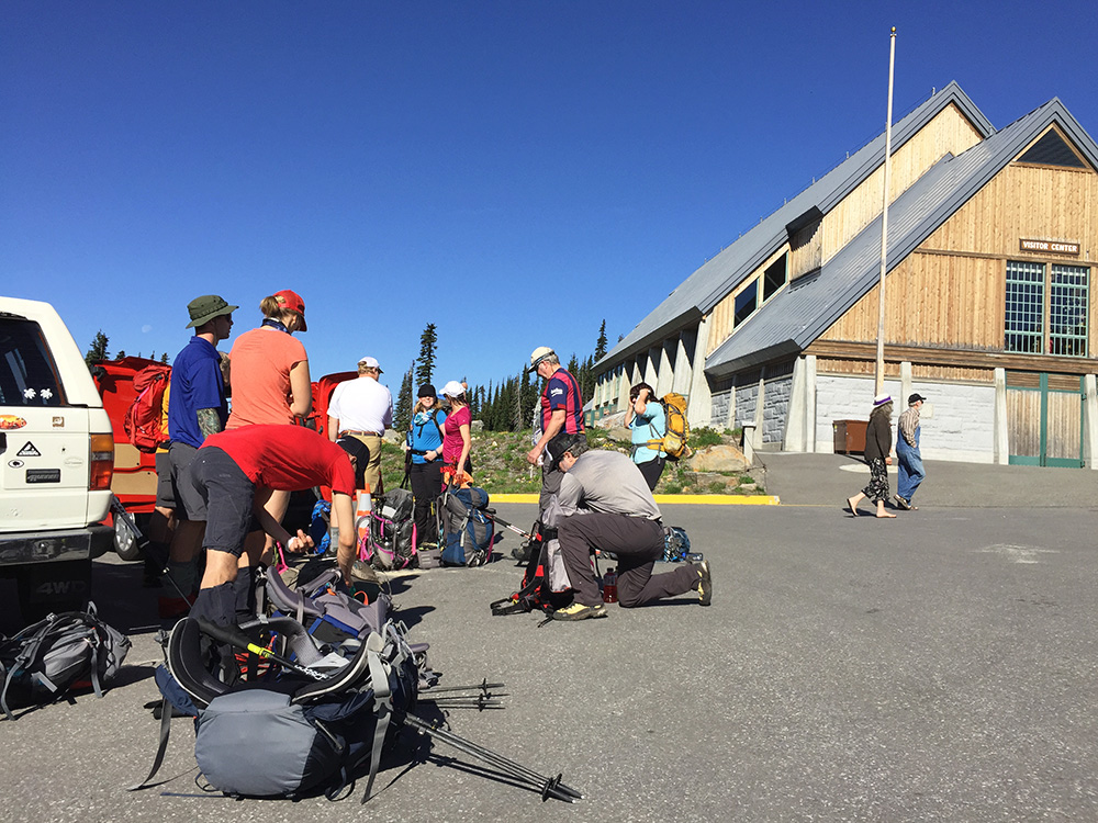
After two decent hikes to Pebble Creek for the past two training hikes, this time we stepped it up with our first of two hikes up to Camp Muir. This is the same route we will be taking on our first official climb day and where we will be spending the night before our summit bid on the second day.
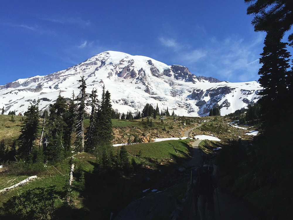
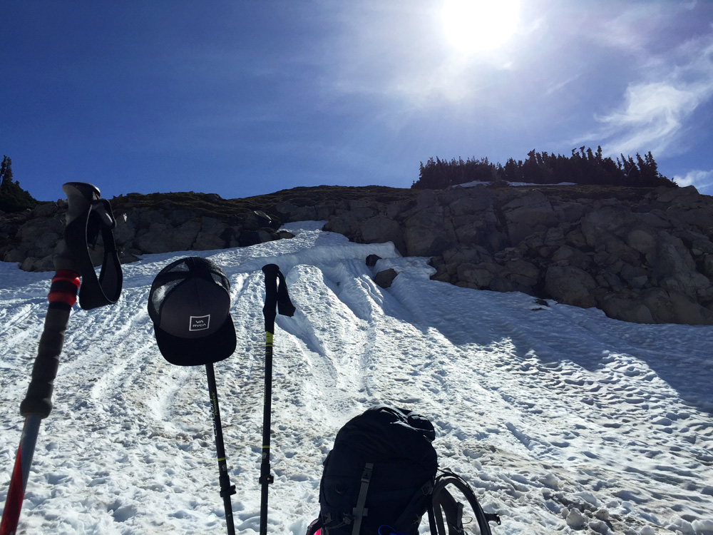
Our abnormally warm and dry spring continues and this day was no different. The weather gave us completely clear skies and warm temperatures, with the temperature already in the mid 60s for our starting point at Paradise just before 9am. Sunscreen and hydration were the buzzwords throughout the entire hike as the freezing level was at 16,000 feet (above Rainier’s summit) and temperature at Camp Muir were forecast to be near 60 degrees by the afternoon. My convertible hiking pants were quickly zipped off to shorts before beginning, something I would regret by the end of the hike later.
By 9am we were on our way up the mountain via the same Skyline (summer) route. It’s always amazing to see how much the landscape of the mountain changes during the transition into summer as the snowpack has begun decreasing rapidly. Our rather warm winter and now spring this year are also contributing to rapidly accelerating that change. All of the meadows just above the Paradise parking lot were now green with wildflowers emerging everywhere. The snow line was quite a bit higher than it was just two weeks ago — now about one-half to two-thirds the distance up to Pebble Creek (~5500 feet). Hiking in mountaineering boots on the rocks and hard ground is considerably worse than hiking in the forgiving snow. And this will only get worse over the next month as the snowpack continues to melt away, exposing the steeper trails sections underneath.
Our first break was a little over an hour into the hike at 1115a and at the first substantial area of snow at around 6500 feet. Our volunteer guides reminded us more about the rest-step method when ascending steep sections and pressure breathing, which will be more important at higher elevations above Camp Muir.
We then continued our trek up past Pebble Creek, which was our destination for the past two training hikes here, to an elevation of about 7800 feet where we stopped for our second break. Unfortunately we still had the steepest part of the entire hike ahead of us where the route steadily climbs from 8000 feet up to just below Camp Muir.
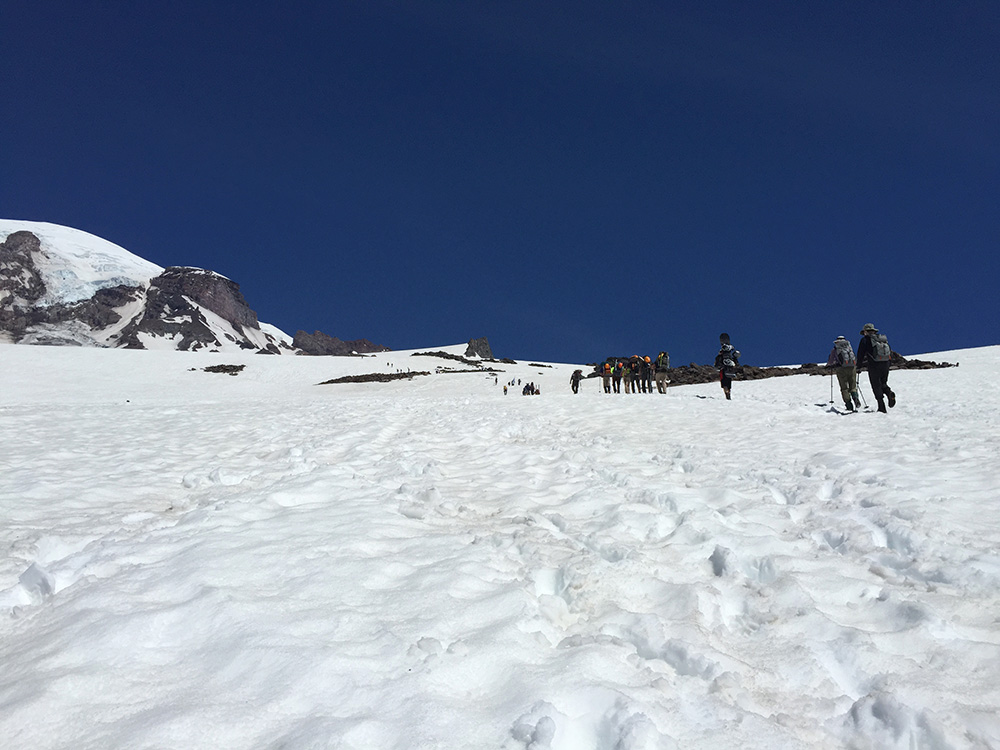
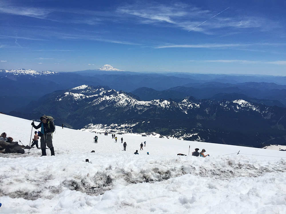
After our brief 5-10 minute break we were back on the trail. This was definitely the most grueling and exhausting part of the hike, both mentally and physically. Physically, it was an endless relatively steep incline for a mile and a half and 22o feet of elevation gain. You’re already pretty exhausted. Your feet are already in pain. Mentally, the vast Muir snowfield made it very difficult to visually track your progress, so it felt like you were crawling. You look up long the route and can’t see Camp Muir at all, and as soon as you think you’re nearing the top of the steeper climb, more suddenly appears. You don’t have features in the landscape to judge your progress either, everything is so far away. This part could easily be equated to crossing sand dunes in a desert. You’re mind and body are in a constant battle with each other for 2000 feet, your mind wanting to take a break with your body knowing it still has a lot left in it to push through.
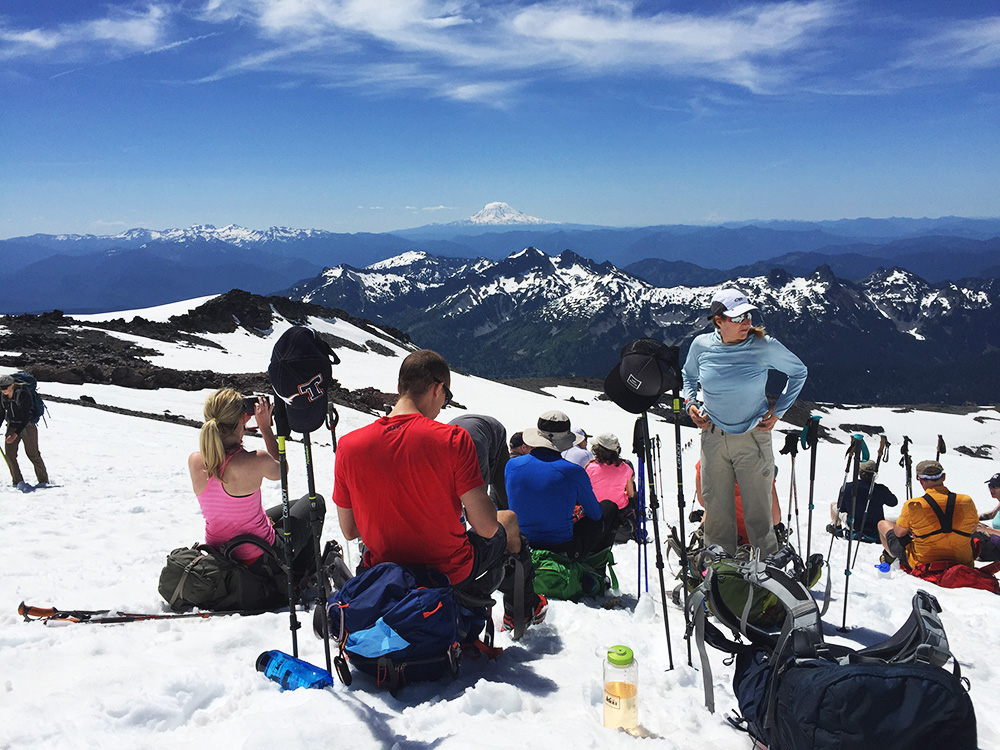
At about 9000 feet we took our third and much needed break. By now we had progressed far enough up the slope that the route starts to decrease in intensity in its approach to Camp Muir. Fortunately, we could also see Camp Muir way off in the distance, kind of a lighthouse and beacon of inspiration amidst a sea of snow cover. Just being able to see Camp Muir and having that ability to visually judge how much farther it was helped ease the mental struggle substantially that took over for the past 1000 feet.
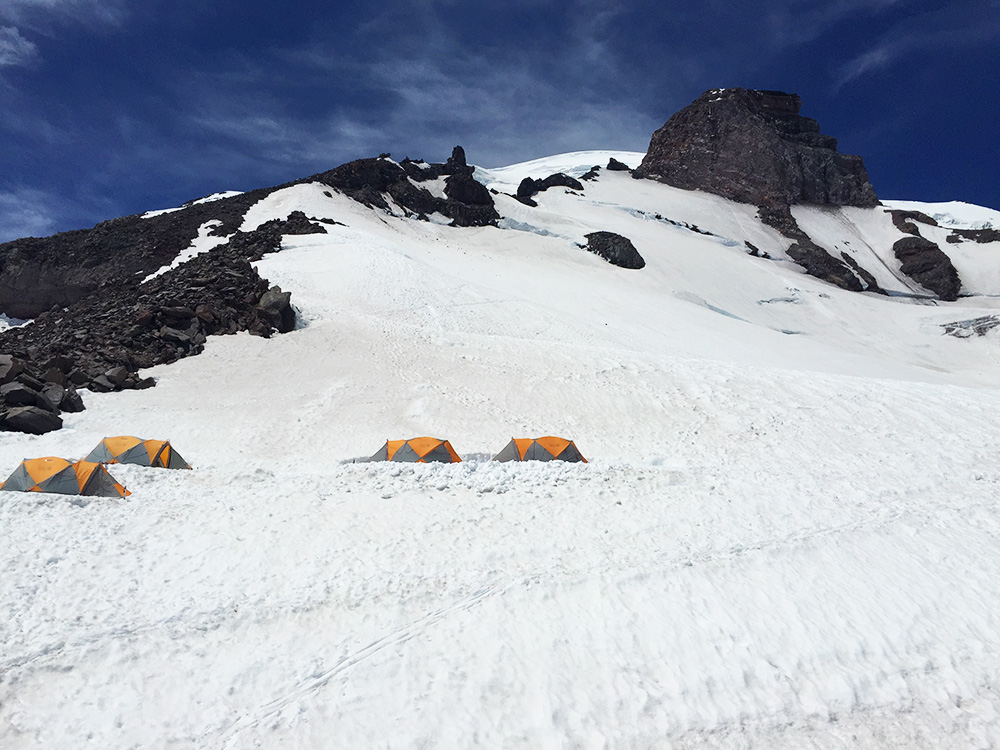
With some quick hydration and calorie consumption are continued on for our final push up to Muir, rest-stepping nearly the entire way at a steady rhythm. And before we knew it, we had finally arrived to Camp Muir, found a nice spot in the snow, dropped our packs and gathered around for our longer lunch break. Our goal was to make it to Muir by 2pm, and we had arrived just under that — around 145p. We had broken up into three groups on the way up, and the first two successfully made it to Muir. The smaller third group unfortunately weren’t able to and stopped just above Pebble Creek before turning around.
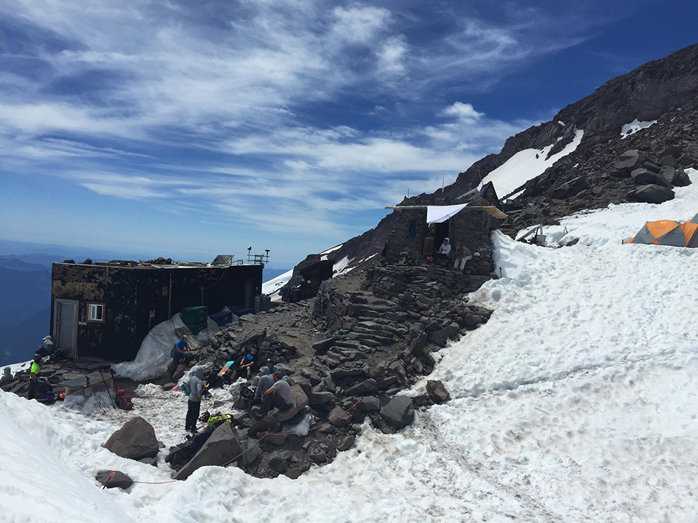
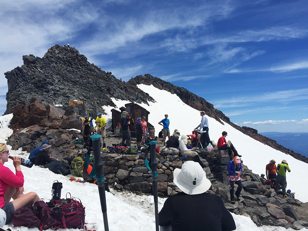
Camp Muir is a nice spot to meet fellow climbers, especially those coming down who were able to summit earlier in the morning. The cluster of huts and tents around the camp feel very similar to those you’d see in movies and documentaries of Everest. Skies were still clear and temperatures were likely in the upper 50s to near 60 with a little bit of a breeze at Muir. The views were amazing, essentially standing higher than everything else around you in the Cascade range except for the handful of other volcano peaks in the region.
Thirty minutes later we began our descent back to Paradise at around 230p. Traversing the vast Muir snowfield was extremely quick and pleasant due to the extensive snowpack. Huge strides and knee-forgiving steps allowed us to arrive back to Pebble Creek in a matter of no time. There were long glissading shoots already carved out into the snow for the long, steeper sections which many from our group took advantage of. Some of us took a brief break for water and sunscreen re-application around Pebble Creek and continued our descent. Climbing up the mountain without snow is bad enough, but descending was far worse as we quickly found out by the time we reached the end of the snowpack. By this time (300p) tourists had already flooded the trail from Paradise trying to reach the snow level. Unfortunately not all of the tourists respect this landscape as much as they should, tromping all over the meadows and ignoring the signs posted about staying on the trails.
Sore and exhausted, our first group arrived back to the Paradise parking lot between 430 and 500p. The sun was relentless up on the mountain, and I was sunburned everywhere that was exposed, even areas you don’t normally get burned like your ears and under your nose. And remember my decision to zip off my pants into shorts at the beginning? I had discovered I had a nasty 3″ sunburn stripe on the back of my legs between the bottom of my shorts and top of my gaiters were. This burn was far worse than I originally expected, forcing me to deal with the intense pain for an entire week before it fully healed and the pain subsided.
Afterwards several of us met up at Whittaker’s again for food and beer to wind down before starting the long drive back to Seattle. Overall it was a good, though exhausting, hike up to Muir, and hoping the next one in three weeks will be slightly easier.