Training: Mailbox Peak
Finally, our Rainier training starts ramping up considerably as we quickly approach the two-month point. I missed the Mount Si training hike last week due to a sudden, yet brief, case of the flu. I was recovering pretty well by the time last Saturday rolled around, though still not quite back to 100% and decided to omit this hike in order to avoid going into flu relapse, which would only further postpone my ongoing gym and outdoor training.
This time it was Mailbox Peak, probably one of the more feared of the popular hikes around the North Bend area simply due to the crazy steepness that you have to endure for four grueling miles. Not only is this trail challenging, it has become highly eroded over the years making the trail less evident and resulting in many hikers getting lost and requiring rescue missions. Even the trail description offered by the Washington Trails Association makes it sound overwhelmingly daunting:
The old route up Mailbox Peak holds a special place among the peaks along I-90. It has traditionally been a rough climber’s trail, an unrelentingly steep, rooted, rocky, muddy torture test, a crucible in which the summits of summer are forged. More than almost any other trail, it assaults gravity with single-minded determination, proceeding more or less due east straight up a ridge line to the summit, gaining some 3,800 feet in two and a half miles after an initial short jaunt up a DNR road. There is nary a switchback in sight.
But that all changed late last year with the opening of a newer trail up to the summit. This new trail offers an easier and considerably less steep route up to Mailbox Peak; but, with a reduction in steepness comes a longer hike.
So once again we all meet up around 8:45 am for our 9 am start up the trail. The weather this time was the best it’s been since our first training hike at Rattlesnake Ledge — mostly clear skies and cool temperatures. Surprisingly the trailhead was already pretty packed this early with cars spilling out of the main parking lot and onto the road. I was hoping this wasn’t a sign of just how crowded the trail was going to be. The one downside to having an easier trail up to the summit is that is makes the trail more appealing and accessible to the “fair day” hikers, those who tend to be obnoxious, loud and disrespectful not only to other fellow hikers but also to nature all along the trail and especially at the summit.
The ascending pace was pretty good, averaging about a mile every 30 minutes with a 10 minute break every hour. The volunteers leading the hike try to mimic the pace and break schedule we’ll see once we’re on Rainier for the big weekend (except for the pace, which will be slower due to increased steepness of course). Another benefit to these training hikes is that the volunteers provide you with plenty of useful information to be more prepared for the climb up Rainier, especially since most of them have done the same Climb for Rainier program through the ALA and are avid outdoor enthusiasts and/or mountaineers.
After about four miles of hiking along this new trail and an elevation gain of 3900 feet, we finally reached the point where the new trail joins the old trail for the final approach up the summit. This last section along the old trail is a steep and treacherous hike up nearly 1000 feet in half a mile, and was extremely grueling after a steady hike for four miles. We were all exhausted and worn out, and it seemed as if this half mile went on for two. The most challenging part mental during this final approach to the summit is probably the last quarter mile, which consists of a completely exposed climb up the steepest section that you can clearly see from below. Just seeing this is enough for many people to call it quits, never reaching the summit, so it definitely requires a lot of mental strength to push through the pain and exhaustion in this final push.
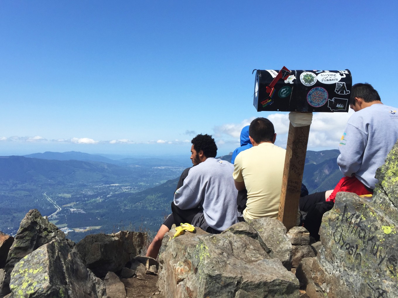
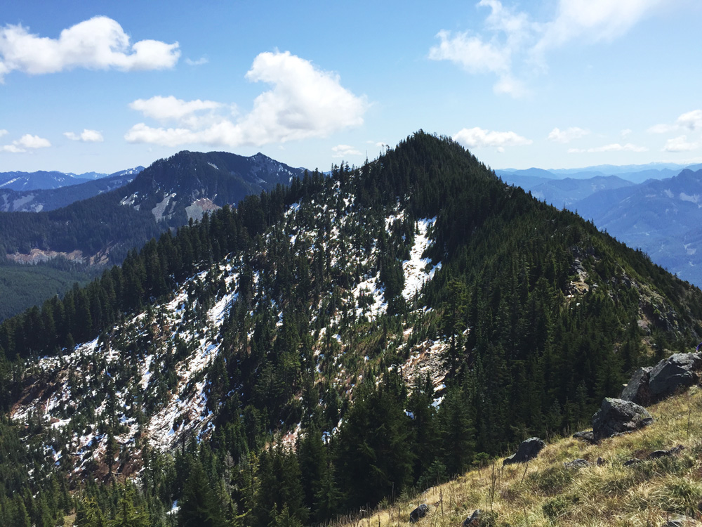
Once at the summit, we were all rewarded with warm sun and great views of the central Cascades surrounding North Bend. Off to the east you could see the skylines of Bellevue and Seattle, and to the south you could see Mount Rainier hiding behind a cluster of clouds. The summit was surprisingly crowded since we didn’t really see many hikers most of the ascent, but not surprising considering the parking lot condition earlier.
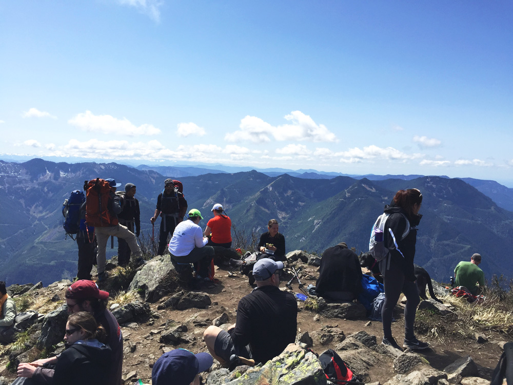
After about a twenty minute break, a lot of water and some food to refuel, we took a quick group picture and started our descent. Jason and I were in the first group, which did get separated from the second slower-paced group, so our group photo was just our first group. Just about 200 feet down from the summit we ran into the second group, so we (painfully) hiked back up so we could take another group picture with everyone. So after another quick break and more photos, we all began the descent finally.
Once again we took the new trail back down, which our knees thanked us for since the considerably steeper old trail is hell on your knees when descending. Though while our knees enjoyed the easier descent, our feet definitely did not, and by about halfway down my feet were already hurting and it was becoming more and more difficult to endure the pain both mentally and physically. Four and a half miles down, and we were done. Finally.
Mailbox Peak is definitely an excellent training hike for Mount Rainier. Though if I were to do this hike again, I would choose the old trail up (quick, but more steep), and the new trail down (easier on the knees). Jason and I did the old trail up and down last fall and while it was pretty painful physically, it’s shorter distance made it feel easier mentally.
Next up, we finally get to venture to Pebble Creek for our first training hike on Mount Rainier.