Training: Pebble Creek @ Rainier – Winter Route
Finally, our first training hike on Mount Rainier from Paradise to Pebble Creek, which is about one-half the distance to Camp Muir.
The hike started at the usual 9AM, which meant we had to get up quite a bit earlier to get ready and drive the 2.5 hours from downtown Seattle to Paradise in order to arrive by 8:30AM. The weather was similar to that of Mailbox Peak last weekend, mostly clear skies and relatively mild conditions. With temperatures forecasted to easily approach 80 degrees in Seattle and the Cascade foothills, it was definitely going to be a warm one up on Rainier. The upside of the drive was that we discovered some back-roads that would be absolutely amazing on a motorcycle farther south closer to Rainier (especially WA-7), roads the Ducati would love.
Leaving at 6AM, we arrived to the Paradise parking lot just before 8:30AM, passing Rainier Base Camp, which is essentially our guide service Whittaker Mountaineering/RMI reside. A good portion of our group was already there and geared up. So we throw on our mountaineering boots and gaiters and get our packs (~25-30 lbs) ready to meet up with the full group for a brief summary of the hike before heading out.
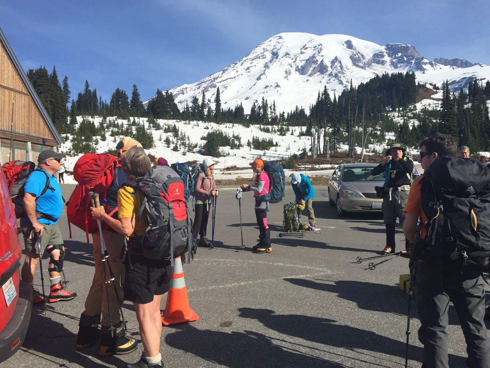
The biggest thing that stood out even before getting to Paradise was the extreme lack of snow cover at these higher elevations for this time of year. We didn’t really see much snow until we got to Paradise, whose snowpack according to the Northwest Avalanche Center (NWAC) is running at 39% of normal. Elsewhere across the Washington Cascade range snowpacks are running considerably lower, so Rainier isn’t fairing as badly as many other observation spots.
CLIMATOLOGICAL SNOWDEPTH INFORMATION
NORTHWEST AVALANCHE CENTER SEATTLE WASHINGTON
DAY  1  MONTH  5  YEAR  2015

DATA IN INCHES, -99 DENOTES MISSING DATA

            CURRENT  CLIMATE  PER CENT   LAST  THRU 2014  THRU 2014
            DEPTH    AVERAGE  OF NORMAL  YEAR  MAX/YEAR   MIN/YEAR

HURRICANE     7       97        7         78   170/2011    25/2005
MT BAKER     13      143        9        157   270/1999    20/1934
STEVENS       9       83       11         94   141/1964    13/2005
SNOQUALMIE    0       60        0         42   131/1974     0/2005
STAMPEDE    -99       80      -99         70   176/1964     0/2005
MISSION       0       34        0         30    56/1999     0/2005
CRYSTAL       0       73        0         63   115/1999    17/2005
PARADISE     62      161       39        178   295/1972    36/1941
WHITE PASS    0       32        0         13    76/2008     0/2005
TIMBERLINE   61      155       39        159   270/1999    43/1977
MEADOWS      17      116       15        116   189/2008    30/2005

THIS TABLE PRODUCED ON THE 1ST AND 15TH BETWEEN 15 NOVEMBER AND 1 MAY.

AVERAGES, MAXIMUMS AND MINIMUMS EARLY AND LATE IN THE SEASON MAY BE
INACCURATE DUE TO LIMITED DATA.

IF THERE IS TIE FOR THE MAXIMUM OR MINIMUM SNOW DEPTH THEN THE LATEST
YEAR IS INDICATED.

RECORDS BEGIN: HURRICANE 1979, MT BAKER 1926, STEVENS 1939,
SNOQUALMIE 1929, STAMPEDE 1943, MISSION RIDGE 1970,
CRYSTAL 1967, PARADISE 1926, WHITE PASS 1976,
TIMBERLINE 1973, MT HOOD MEADOWS 1974.
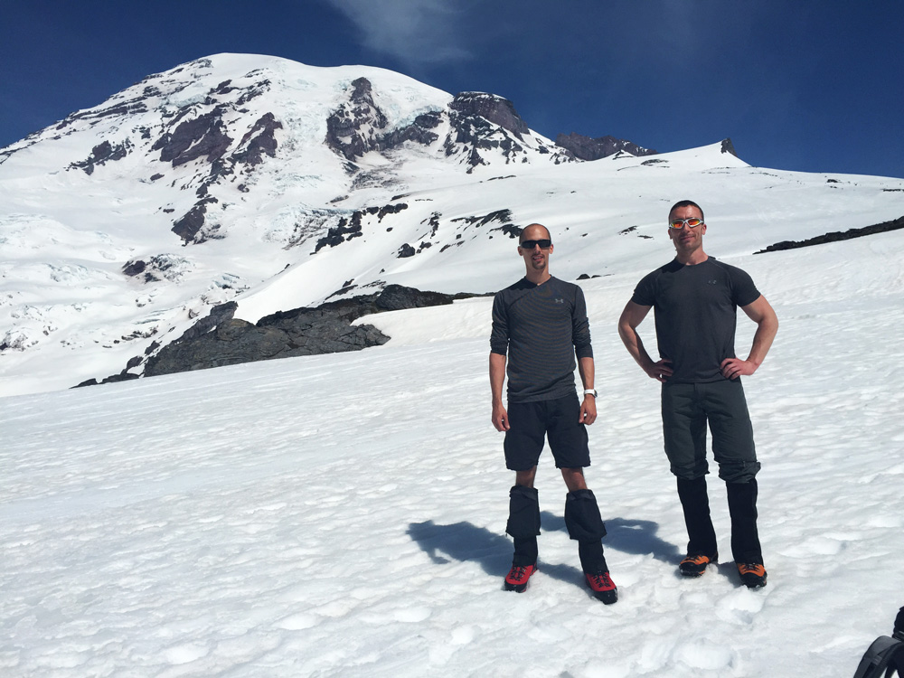
The hike began from Paradise at an elevation of around 5,420 feet. Overall the hike up to Pebble Creek wasn’t bad, and we were moving at a fairly consistent pace. We only took one water/snack break right before the steepest section of the hike about an hour in, which is on par with the one-break-per-hour schedule we are expected to have on our actual climb day with RMI guides.
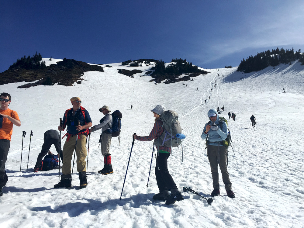 The photo doesn’t show just how steep this section was in the background, and combining that slope with snow made it even more challenging. Luckily the numerous other climbers days before us established a series of foot holes that functioned as steps on the way up. Also, by the time we arrived to this part of the hike it was approaching midday and the stronger sun was making the snow quite a bit softer and slick than it was starting out that morning. The key to climbing this section was slow and with a steady rhythm with one climbers in line with each other. Our volunteer guides also demonstrated the use of pressure breathing, which is forcefully and quickly pushing all of the air out of your lungs. They emphasized that this breathing method will be more important at higher elevations to reduce the effects of altitude.
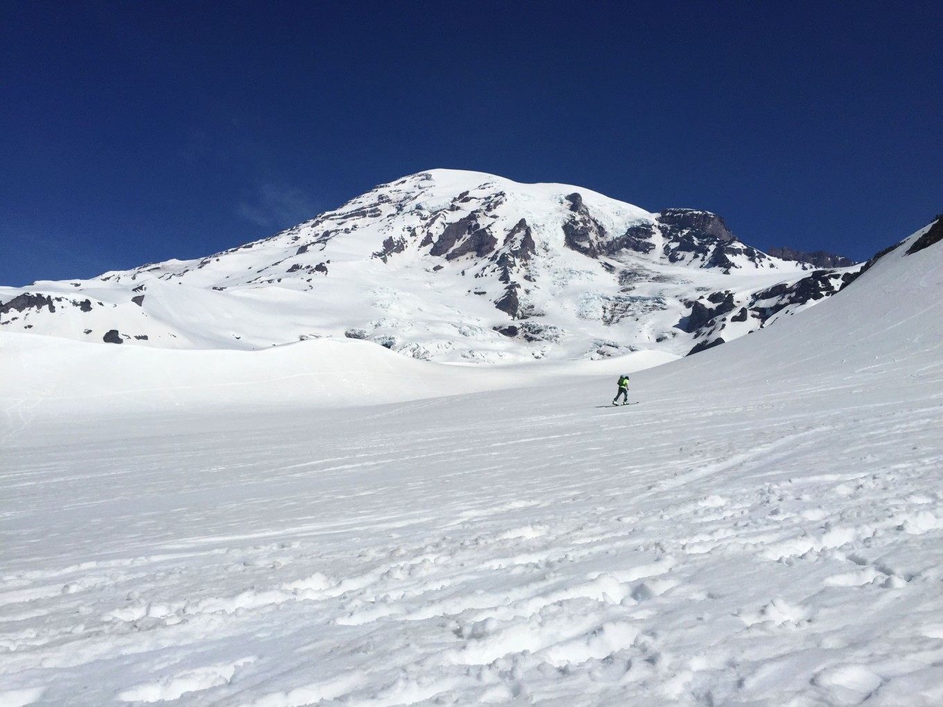
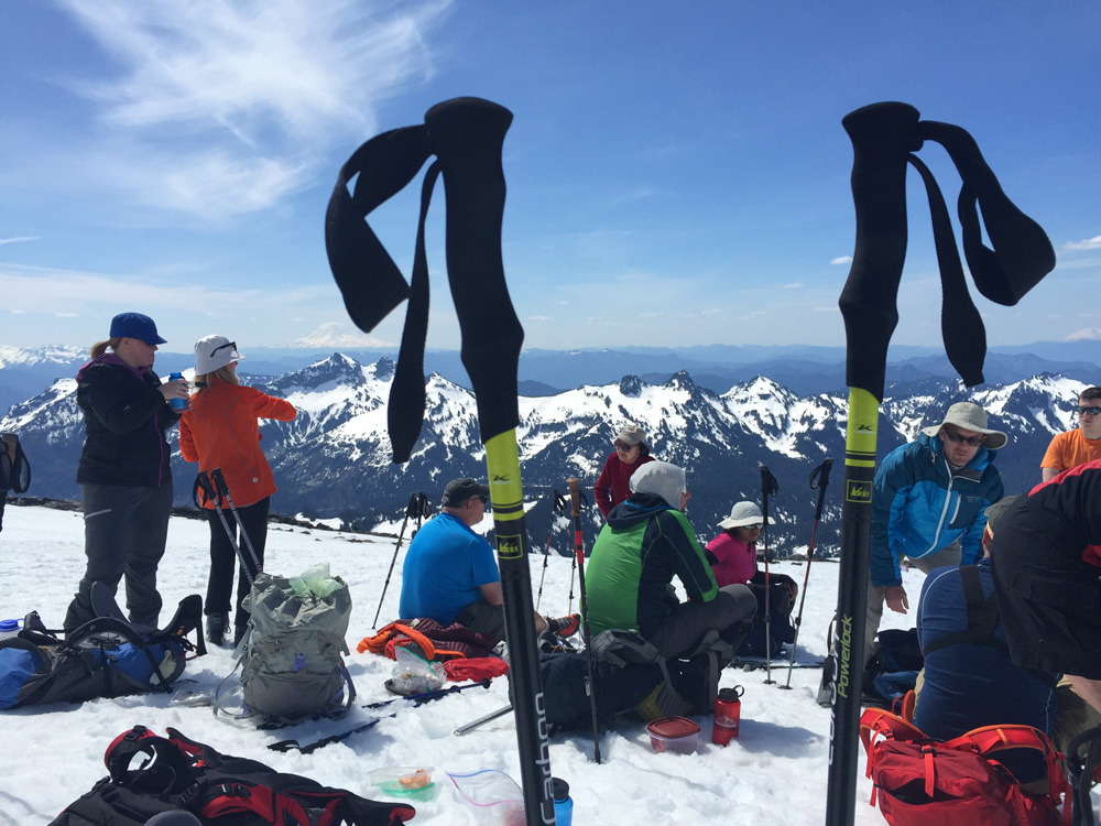
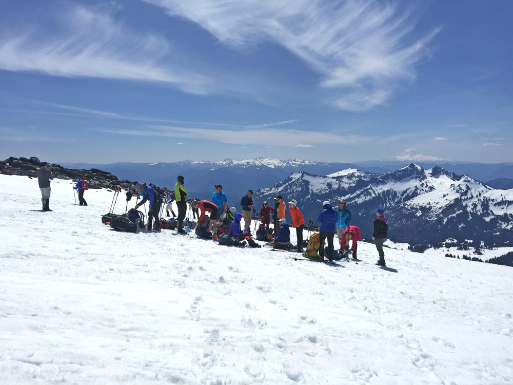
Once we finally reached the top of this steep section, it was about another half-mile of a gradual climb up to our destination of Pebble Creek where we stopped for lunch and a longer break at an elevation of about 7,200 feet. Due to the snow cover you couldn’t really see where Pebble Creek was located, so it was more-or-less a guestimation by the guides based on the surrounding rock landmarks. Our lunch break offered a great opportunity to really view the entire landscape and mountain features surrounding the Camp Muir route, including the numerous southeast-facing glaciers and the Camp Muir huts themselves way off in the distance. By this time of the day, there were already a decent number of people on the route, most of whom were hiking to or near Camp Muir and skiing or snowboarding back down to Paradise. From this spot, you really were above most of the surrounding peaks of the Cascades and could clearly see Mount Adams and Mount St. Helens, even Mount Hood in Oregon, to the south and Mount Baker to the north.
After about thirty minutes, we began our descent back down to Paradise. Ironically enough the descent was more of a challenge than the climb simply because the snow cover had become even more soft and slick. Traversing and descending the few steep slopes without crampons and without loosing your footing and sliding all the way down was interesting, especially for that long steep section just above the midway point. The guides showed us a step method for handling these sections, which for some of us proved less helpful than others. They didn’t want us glissading down, which definitely would have been easier and faster, but it was good to practice their techniques just for experience when glissading may not be an option. Crampons would have helped immensely with these parts in retaining your footing on the descent. Snowshoes would have also been beneficial for the flatter parts where the snow was so soft that your legs sank halfway up or all the way to your knees. Thankfully having gaiters kept snow out of your boots and bottom half of your legs.
By the time we approached Paradise it was already around 2PM and the entire lower half of the trail was packed with tourists. So there were many people wearing nothing but jeans and tennis shoes hiking the lower half of the Pebble Creek trail in soft snow, jeans and shoes soaked. Needless to say, they clearly weren’t prepared for the conditions which can also be dangerous for some parts of the trail considering how slick it really was. Fortunately they don’t get too far up the mountain as too many people, especially tourists, would definitely ruin the experience of being one with the mountain at higher elevations.
After a quick gear change in the parking lot and briefly chatting with some of our fellow climbers, we were on the road back to Seattle just in time that the park was packed. The benefit of getting here and up on the mountain earlier.
In two weeks we do this all over again, giving us an opportunity to try out different gear and determine which layering method works best for us before our actual climb date in a little over two months.
Hike Summary: 4 miles roundtrip, 1,780 feet elevation gain